")
CyanoAlert Viewer
Assess water quality status and risk areas using the CyanoAlert Viewer.
Watch a 1 minute movie about the CyanoAlert Viewer
What is the current status of the water bodies you work with?
Use the web based CyanoAlert Viewer to analyse and view near-real time satellite images and maps of water quality parameters for your areas of interest.
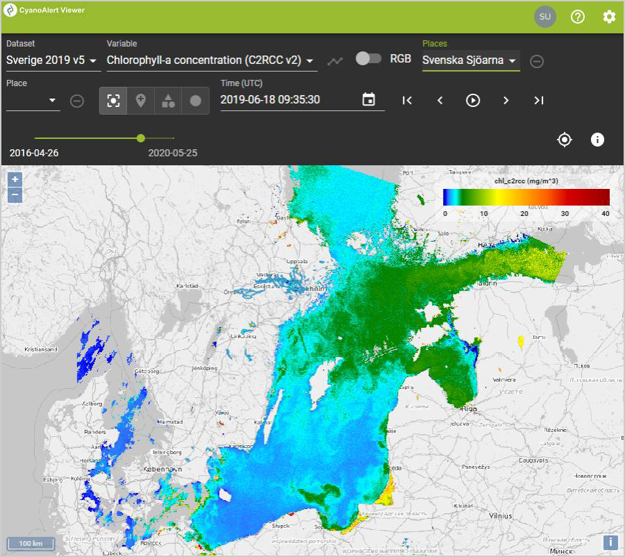
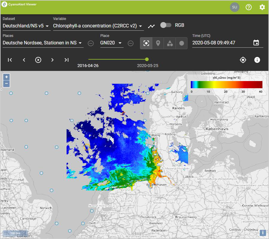
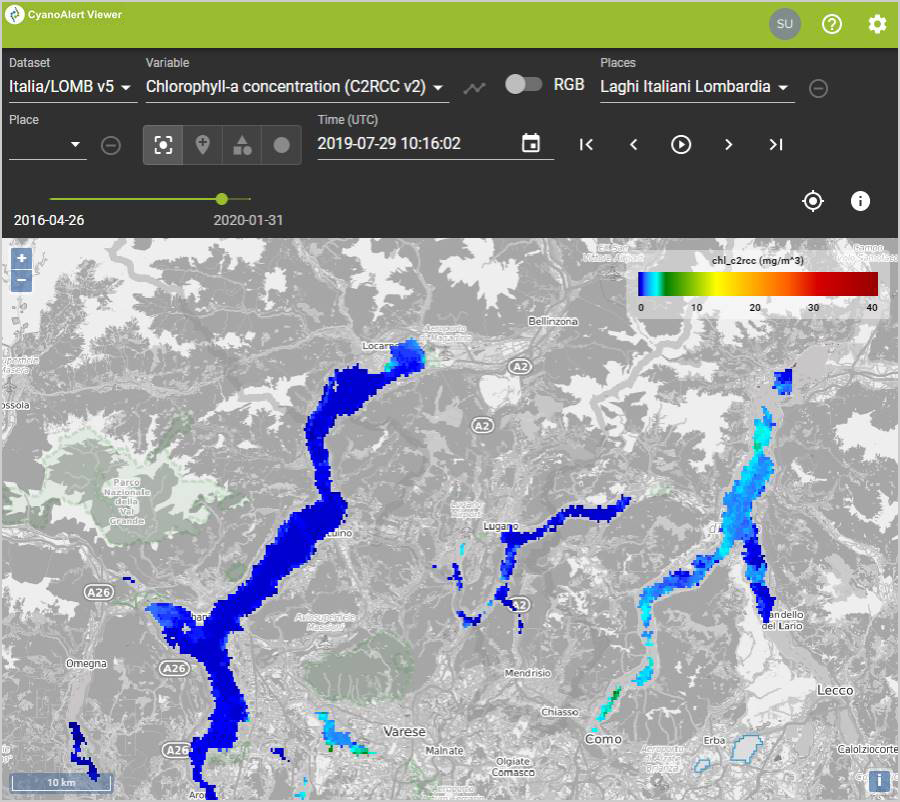
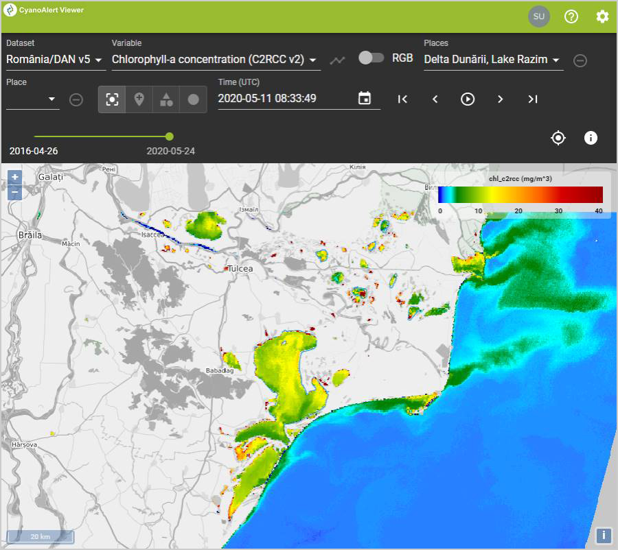
CyanoAlert Viewer, examples of four user defined locations in Europe.
Do you want to know if a specific algal bloom is cyanobacteria dominated?
Check the "immersed Cyanobacteria indicator" in the CyanoAlert Viewer!
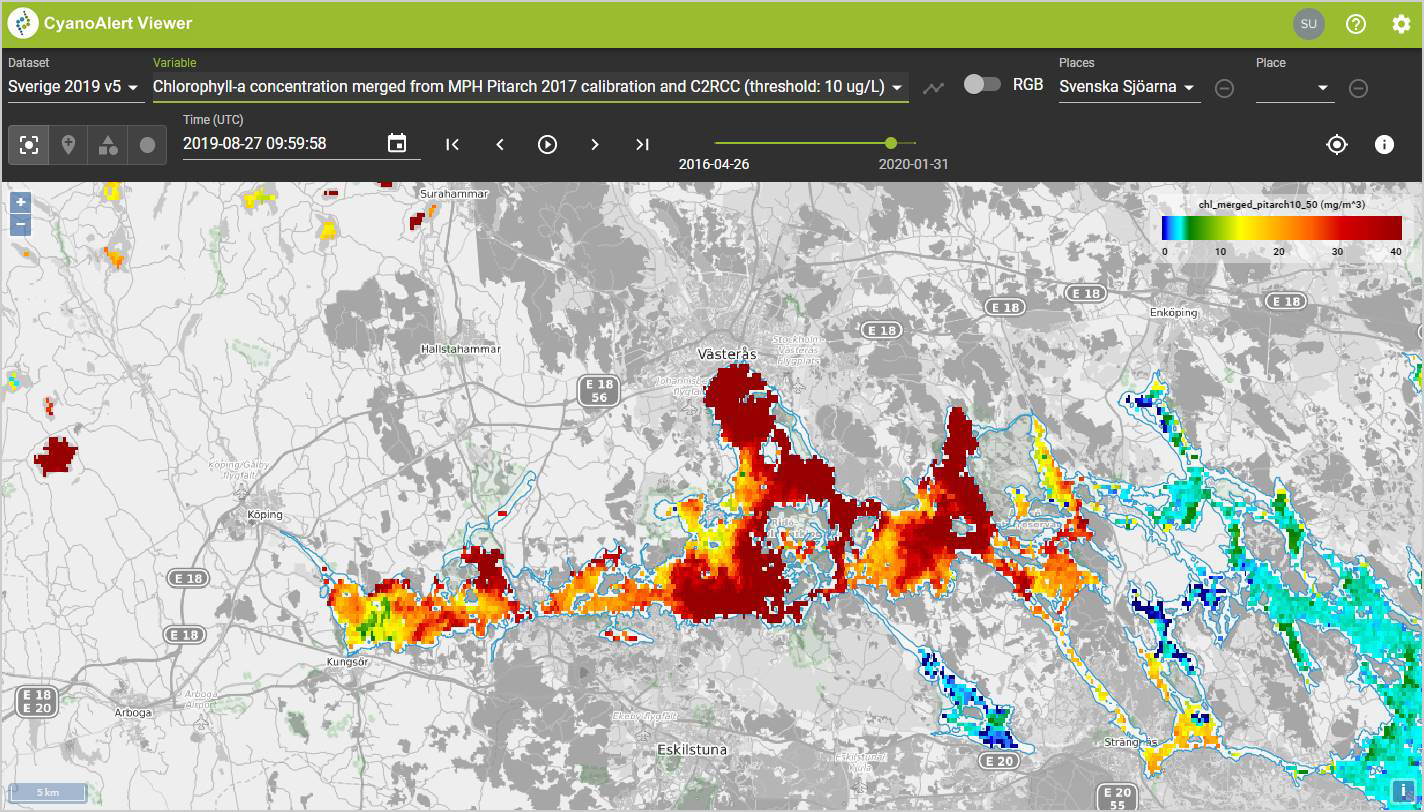
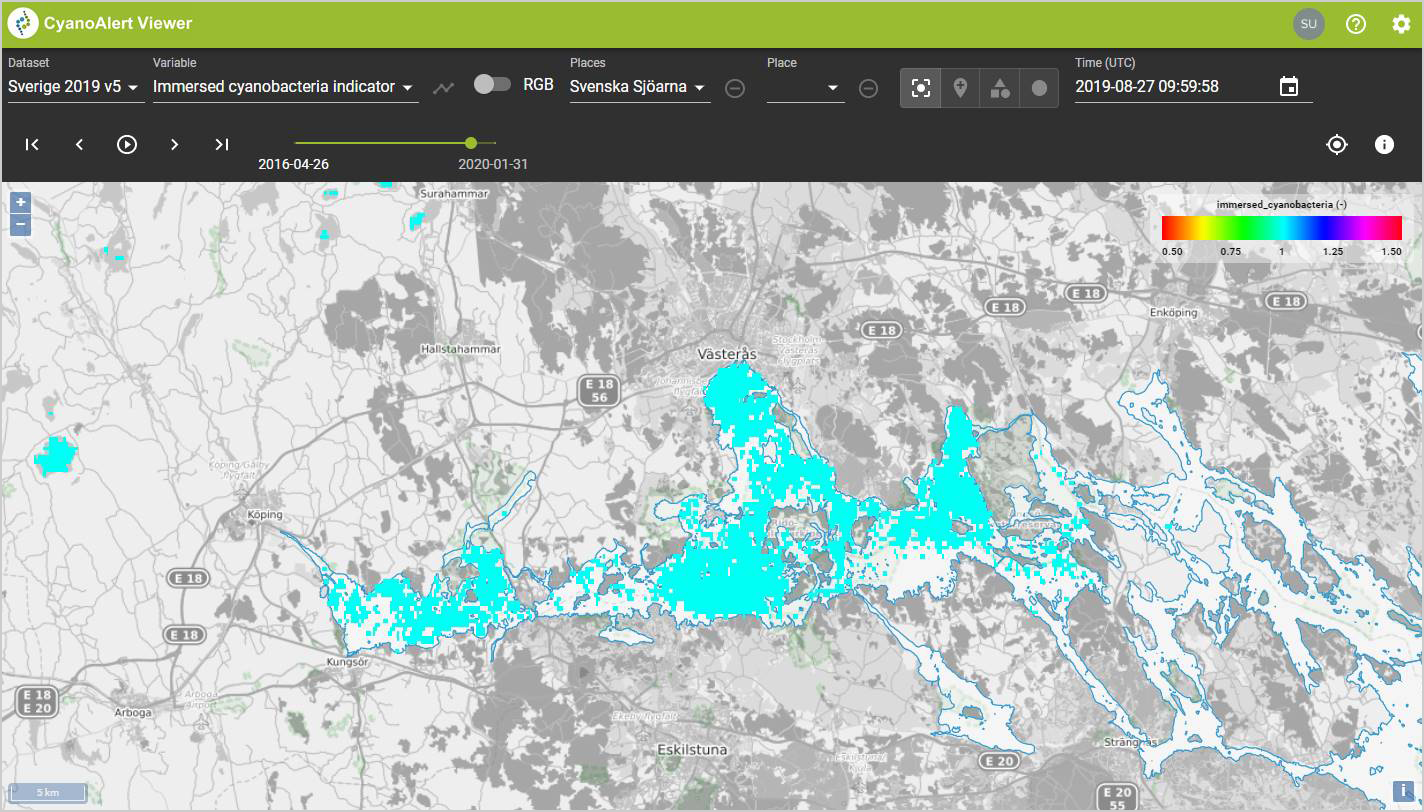
The CyanoAlert Viewer showing maps of Chlorophyll-a concentration (left) and the detection of potentially toxic cyanobacteria in the water (right) from August 27, 2019, for the western end of Lake Mälaren, Sweden.
Create time series of water quality information
Using the Viewer, you can also view graphs and zoom in on relevant time intervals for your applications. Let recent and historical information help guide mitigation activities and set priorities.
Choose a pre-defined waterbody or create new points, polygons and circles.
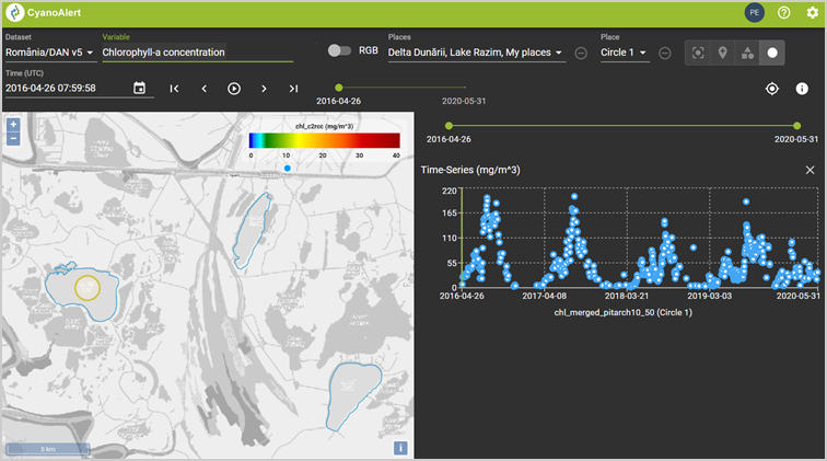
Time series of Chlorophyll-a for a user defined Circle (yellow) in Lake Isac, Danube Delta, Romania. The blue polygons are lake water bodies, pre-defined by the User of the service, and available for time series analysis.